Hey All

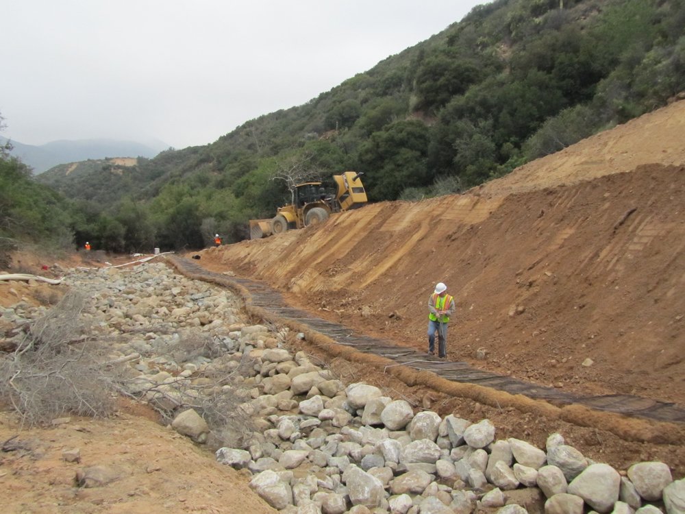
Remember the Schenk Creek project?  It was the little seasonal creek below Highway 330 in San Bernardino National Forest that got inundated with DG sediment when a landslide occurred in the winter of 2010.  Remember District 8 had to design and build some really huge wire mesh-reinforced walls and also remove over 16,000 CY of material from the creek.

I got called in to restore the stream.  See this post for more information.

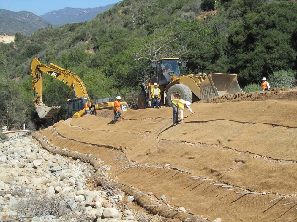
Well, Jason Bill recently sent me some photos taken on August 3rd – Three months later.  See how well the willow worked when incorporated into the restoration work.

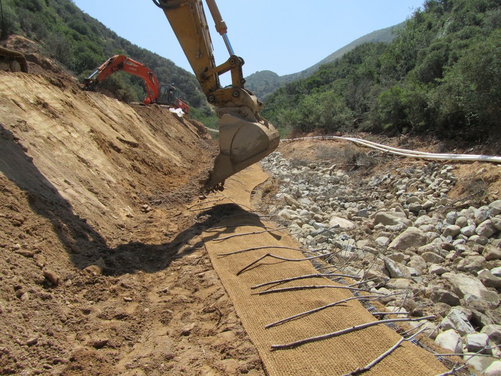
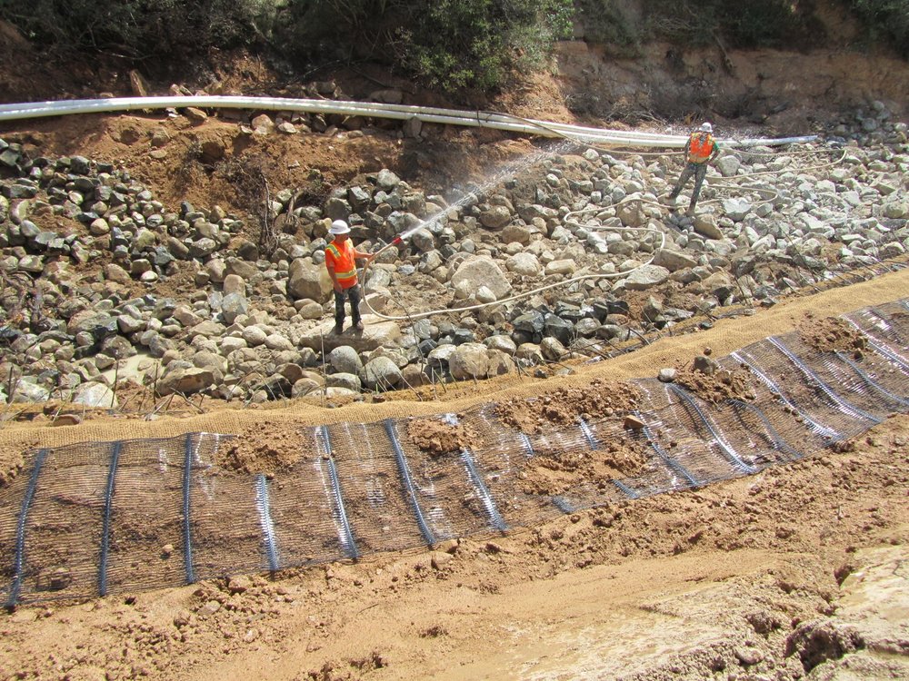
The most interesting and informative techniques/prescriptions used for the stream bank stabilization included Longitudinal Stone Toe (LST) , Live Siltation , and the RSP Soil Flapping.  The LST and Live Siltation techniques are available in the ESenSS Manual (or NCHRP Report 544) and the RECP Soil Flapping Technique comes from a recent course we are teaching for Caltrans Landscape Architecture (See https://www.dot.ca.gov/hq/LandArch/ec/steep_slopes/recp_wrap.htm)

The Soil Flap method is really beneficial for steeper slopes (>2H:1V) that require a some reinforcement.  The horizontal element embedded in the slope provides geotechnical reinforcement while the “flapping” element provides erosion control.  Soil Flaps are not as strong as Soil Wrap but they are super cost-effective and constructible!

https://www.dot.ca.gov/hq/LandArch/ec/steep_slopes/recp_flap_with_brush_layering.htm

Just a reminder that these techniques and more are available on ESenSS or in the NCHRP Report 544, 2005.  See index to techniques PDF 

Hope you all recall that soaking willow branches for a few days to a month will increase the successful establishment. 
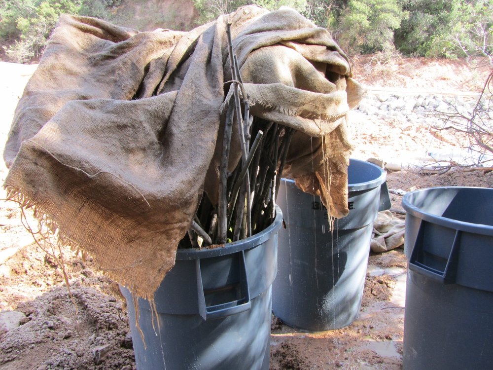
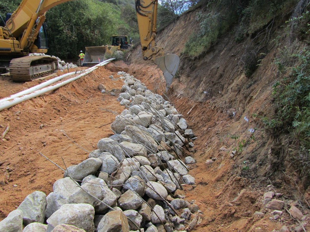
Some more photos here to see how the structures were built in Schenk Creek back in May.
Hope to see you all out in the field and keep your willow branches wet!!

-John

I’m currently down in San Bernardino working with Caltrans District 8.  Hwy 330, going up through San Bernardino National Forest had a rough winter – and a record rainfall season.  The land is really steep, heading up to Big Bear, and landslide riddled. But a couple of plugged culverts lead to a huge landslide that buried Schenk Creek under thousands of tons of Decomposed Granite and rocks. CTs and SKANSKA Construction have been working on the highway for months , installing new drainage facilities, and repairing the landslide.  The Geotechnical Engineers have designed a huge wire mesh reinforcement system.   

Highway 330 slide w/ geotechnically-reinforced wire

The District is also working very closely with the USFS and USACOE, and other Resource Agencies because the downstream reaches of Schenk Creek provide habitat for the endangered yellow-legged frog, very critical habitat indeed.  Which is how I got involved.  David Derrick flew out to help the Corp of Engineers and USFS come up with a restoration plan for Schenk Creek, and then David, in turn, recommended me to furthur develop and oversee implementation of the plan.  

The creek being cleaned out belowOver the last few weeks, CT and SKANSKA have removed an estimated 16,000 CY of landslide material out of the creek.  The temporary access road is soooo steep, a huge 980 Cat Loader needed to be pushed out with a bull dozer!!  I’ve already lost 4 pounds of winter fat humping up the trail !!


 Today we started at the lower end and built a Longitudinal Stone Toe (LST) along the left bank.  We excavated deep so some willow branches (soaked 4 days in heavy duty garbage cans) can get their feet damp, even as the stream dries up this summer.  The branches (live siltation) were covered with damp soil and then furthur “washed in”.

I’ll be pleased if 30% grow as it is not optimal season – but the branches will help roughness regardless.  Our next step is to build a rather large engineered rock riffle – which will add considerable roughness to the system (while mimicking natural riffles observed throughout the system.


Behind the riffles and the LST we will furthur develop flood bench terraces.  The plan is that the benches, the additional roughness added in riffles, and the use of small meanders will all allow the stream to store and meter-out sediment as a naturally-functioning stream.


Well, we have at least three more big pool/riffles to build and quite a bit more DG to remove from the channel, and several more functioning flood terraces to build – so more later.  

Whew, I’m tired already.

-John

Hey Guys,

Last week John did a webinar entitled:  ‘What’s Wrong With Rip?” over at Forester University – you can read the course contents here.  

The course went over really well.  A lot of great information was shared, stories were told, some fun – basically everything you could ever want in a webinar 🙂

Good news:  The webinar is now archived and ready for you to access and listen to at any time!

Simply Click Here, and go do some serious Fluvial Geomorphology Learnin’!


Note:  There was a bit of an audio level issue on John’s microphone in the second half of the webinar.  You may have to play with the audio levels a tad when John’s talking.  Sorry about that – will fix it next time

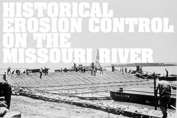
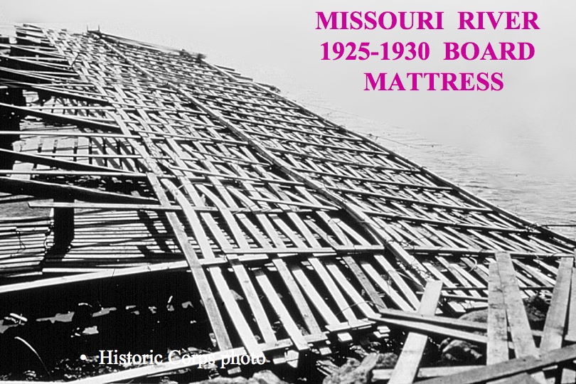
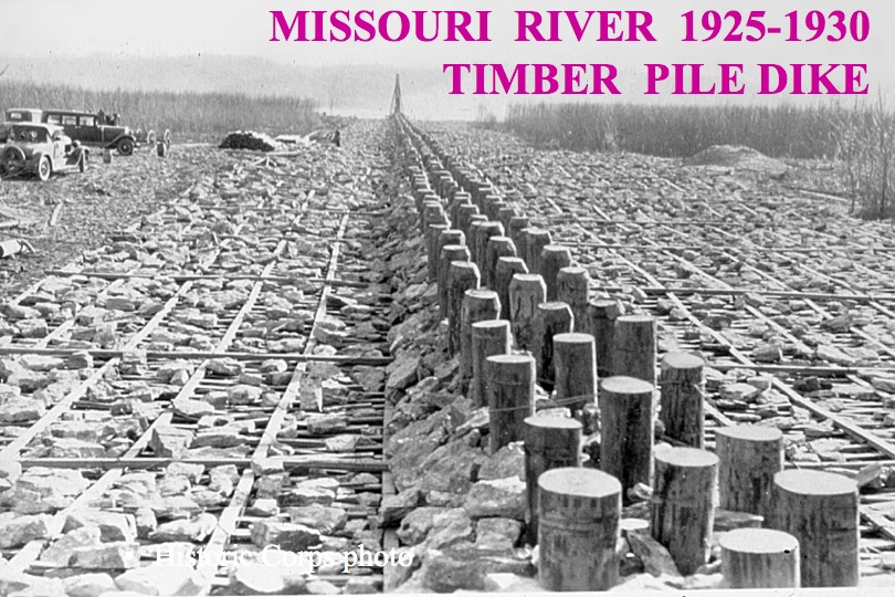
Courtesy of our good friend David Derrick, we have some really great pictures available in the photo (or ‘Pics’) section of our website.

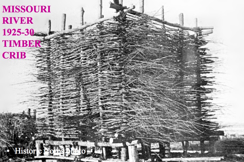
All the photos are 1920-30’s era attempts at Riverbank stabilization, using techniques such as Board Mattresses,  Gabion Burrs and Timber Pile Dikes…  

Huh?  You might be saying.  Yeah, me too.  But once you see the pictures, you’ll notice that these techniques aren’t too far off from current day riprap, gabion baskets, brush mattresses, etc.

Check them out here.  They’re quite neat.


Select your currency
USD United States (US) dollar